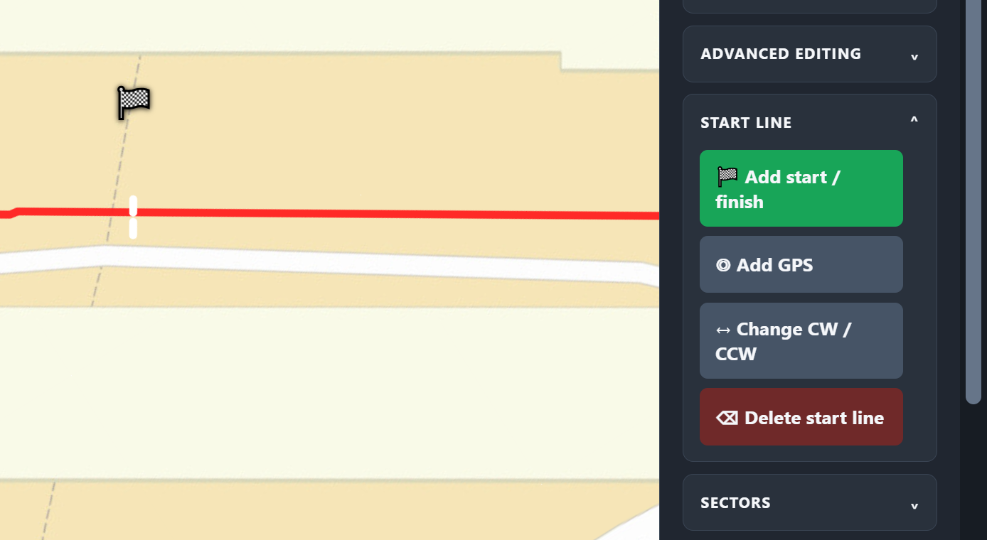
START / FINISH
Anchor the lap correctly.
Place the gate across the circuit or locate it from GPS coordinates. Set clockwise or counter-clockwise direction so every definition follows one lap order.
MOTORSPORT GPX TRACK EDITOR
TrackDay Assistant is a precision GPX track editor for track-day drivers. Import a GPX trace, correct racing-circuit geometry, place start/finish, set race direction, create sectors and mark precise corner entry and exit boundaries—all against real map or satellite imagery.
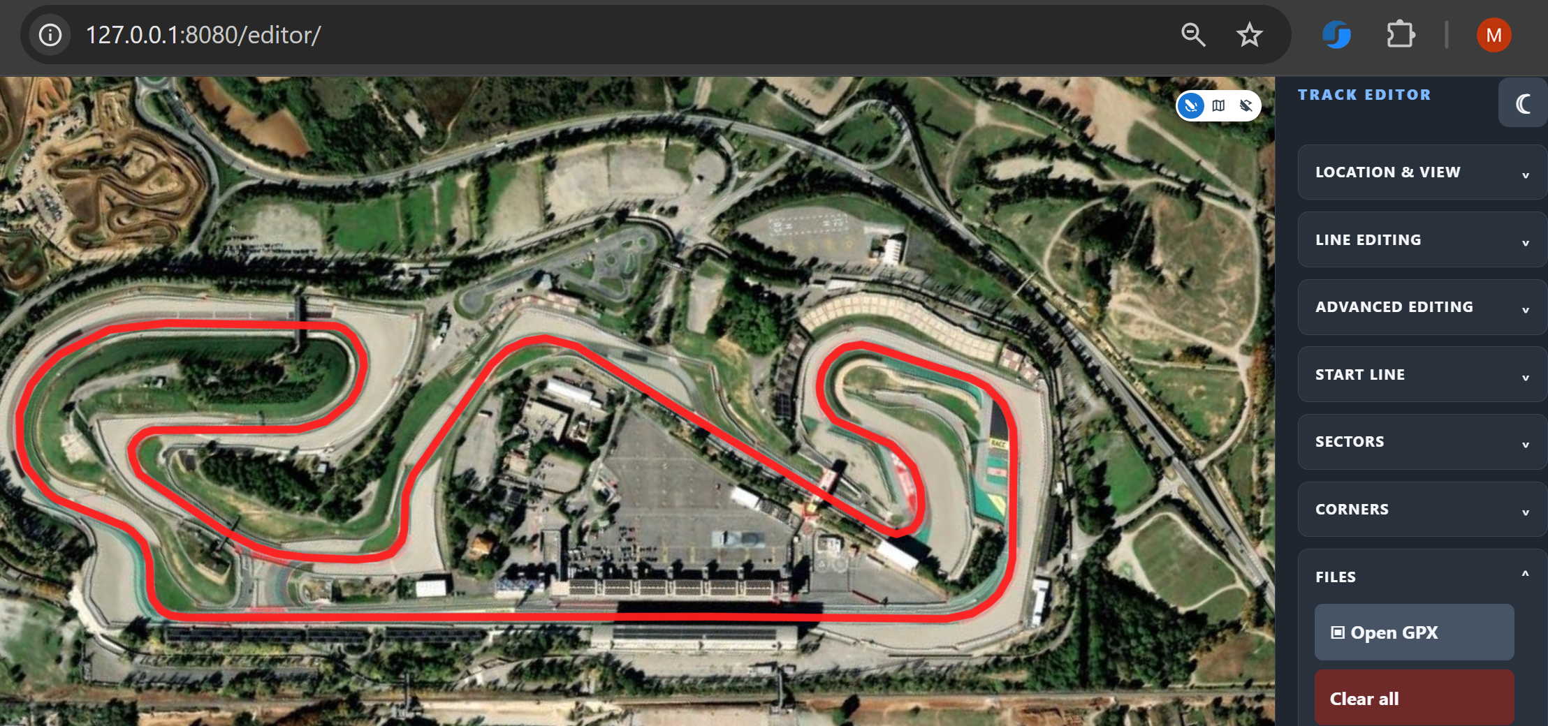 BETA VERSION
ALL FEATURES
Open an existing GPX track or establish the circuit from GPS coordinates.
Align the line to real-world mapping and shape difficult sections with node and curve tools.
Add direction, start/finish, sectors and corner boundaries in their proper order.
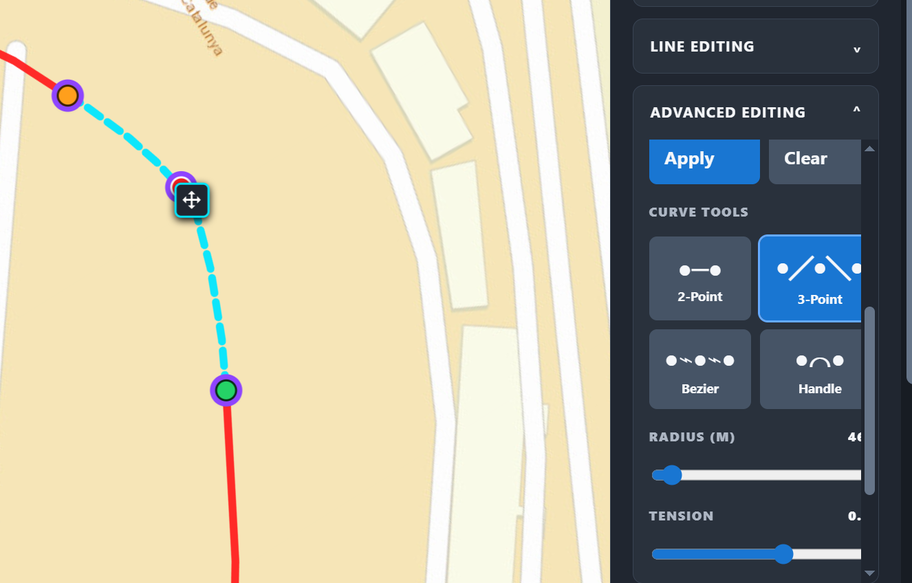
PRECISION GEOMETRY
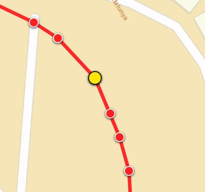
Recorded points rarely reproduce every bend cleanly. Edit individual nodes or reshape a section using 2-point and 3-point tools, Bézier curves and handle-based control. Radius and tension create a smooth, deliberate line that follows the circuit instead of accepting GPS noise.
CORNER DEFINITION
A corner is more than a point near an apex. Set a precise ENTRY and EXIT along the circuit so the full driven section is explicit and remains tied to the trace.
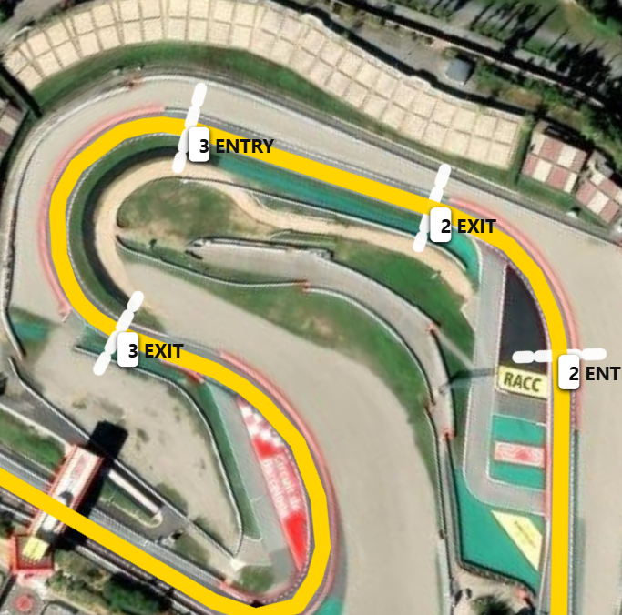
COMPLEX SEQUENCES
Compound bends, switchbacks and linked sequences do not have to become one generic corner. Separate numbered entry and exit boundaries preserve each element, even where one corner flows directly into the next.
SECTOR STRUCTURE
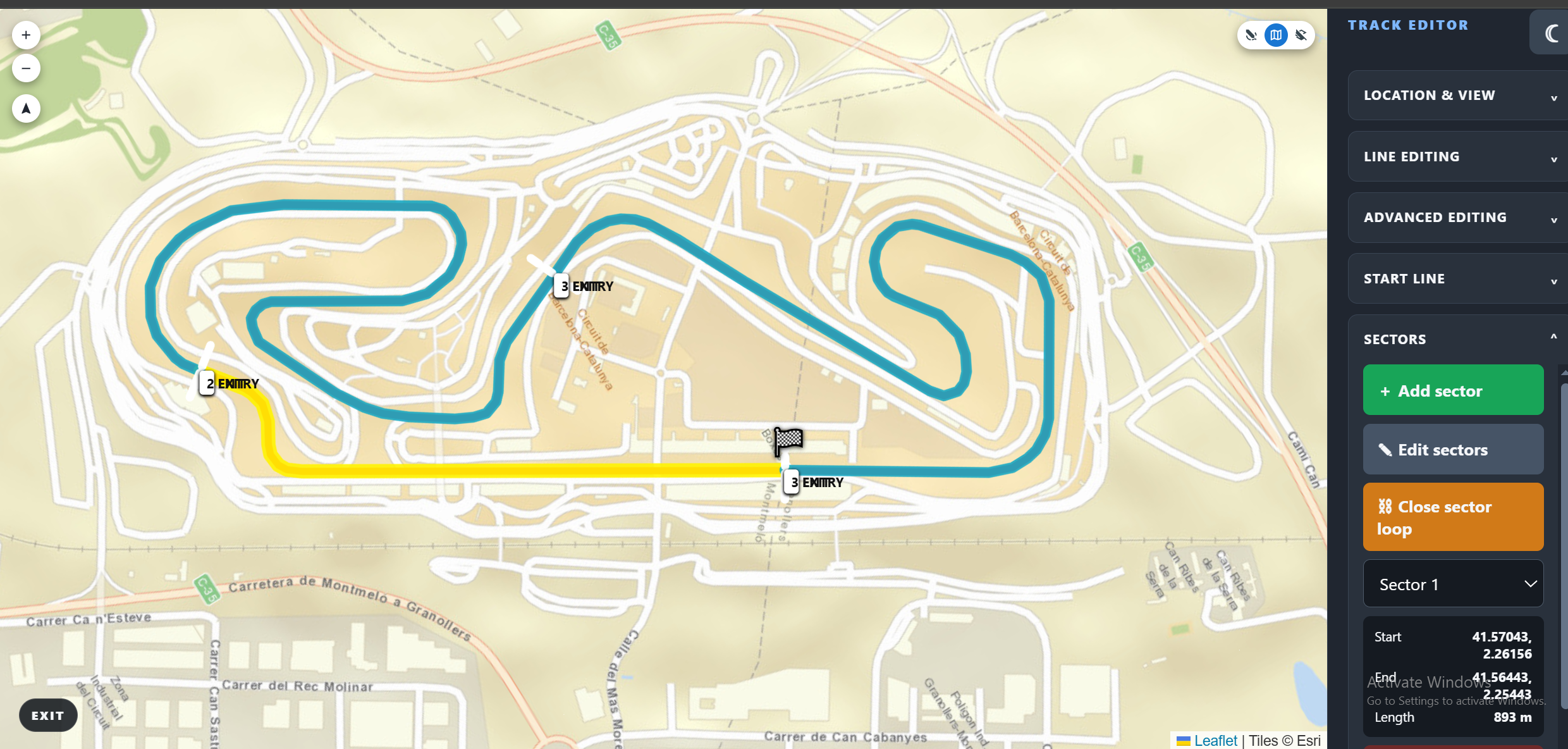
Create an ordered, continuous sequence around the lap. Position or resize each boundary, inspect exact start and end positions and calculated length, then close the sector loop.
START / FINISH
Place the gate across the circuit or locate it from GPS coordinates. Set clockwise or counter-clockwise direction so every definition follows one lap order.
VISUAL VERIFICATION
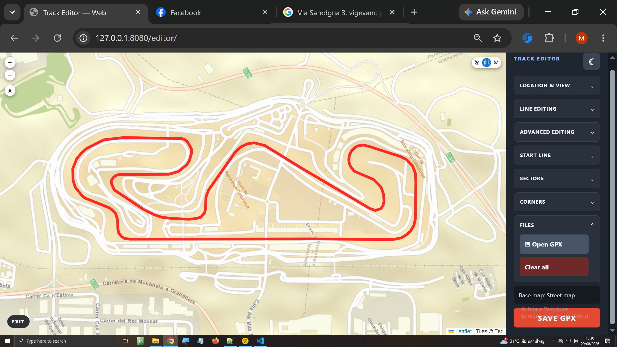
Switch between satellite, street-map and blank views, rotate the map or reset north, and navigate to pasted coordinates. Edit in geographic context, never blind.
THE COMPLETE WORKFLOW
FROM TRACE TO CIRCUIT
Turn raw GPX and GPS geometry into a complete, ordered racing lap ready for precise circuit definition.
MAILING LIST
Occasional product notes, guides and release news.